Two days is enough to see all three faces of Olympic National Park — glacier peaks, temperate rain forest, and wild Pacific coast — as long as you accept one fact up front: no road crosses the park's interior, so the whole trip is a loop around its edge on Highway 101. This itinerary splits your nights between Port Angeles and Forks, the two-base setup park rangers recommend, and covers the drive times, fees, and tide logistics that decide whether the plan works or collapses.
Is 2 Days Enough for Olympic National Park?
Olympic covers 922,650 acres and protects three ecosystems that share a boundary but no roads: the Olympic Mountains, where Mount Olympus rises to 7,980 feet; old-growth rain forest on the western slopes; and 73 miles of wilderness coastline. Everything connects by Highway 101 around the outside. So drive times, not trail times, shape your two days.
| Destination | Drive from Port Angeles |
|---|---|
| Hurricane Ridge | 45 min |
| Lake Crescent | 30 min |
| Sol Duc Valley | 1 hr 15 min |
| Mora / Rialto Beach | 1 hr 15 min |
| Hoh Rain Forest | 2 hr 15 min |
| Kalaloch | 2 hr 30 min |
Those numbers answer the feasibility question. Two days buys a greatest-hits run — mountains, waterfalls, and the lake on Day 1 out of Port Angeles; rain forest and coast on Day 2 out of Forks — but it can't absorb the far corners. Skip Ozette, Staircase, Quinault, and Shi Shi Beach on this schedule. Each adds two or more hours of driving, and Shi Shi also requires a Makah recreation permit.
Add a third day if you want weather slack — clouds hide the ridge often enough that a buffer matters — or if you want a soaking afternoon at Sol Duc and the southern Quinault valley. Otherwise the plan below runs clean on a summer weekend.
Before You Go: Fees, Passes, Reservations & Current Conditions
Entry costs $30 per private vehicle, valid for 7 consecutive days; motorcycles pay $25 and walk- or bike-in visitors $15 per person. The park is cashless. Pass options include the $55 Olympic annual pass and the America the Beautiful interagency pass. Buying ahead on Recreation.gov shortens the wait at the entrance station — see our rundown of park hours and fees for the full picture.
No timed-entry or advance reservation is required to enter. A pass is all you need. Permits only enter the picture for overnight backcountry: a Wilderness Camping Permit runs $8 per person per night plus a $6 reservation fee. Peak-season campgrounds (Hoh, Kalaloch, Mora, Sol Duc, Fairholme, Staircase) also take reservations through Recreation.gov. If you're flexible on dates, 2026 free-entrance days fall on February 16, April 19, August 4, September 27, and November 11.
A few current conditions matter. The Hurricane Ridge Visitor Center burned down in May 2023 — only toilets and trash bins remain at the top. The Mora Road corridor to Rialto Beach is expected to close from July into early fall 2026 for storm-damage repairs, which affects the sunset option in Day 1. In winter, Hurricane Ridge Road opens only Friday through Sunday and chains are required, and Sol Duc Road closes for the season.
Getting There & Where to Base Yourself
From Seattle or SeaTac, figure roughly 3 hours to Port Angeles. The fastest route uses the 30-minute Bainbridge Island ferry from downtown Seattle; the Bremerton crossing takes an hour, and the Kingston–Edmonds run often has long waits. A rental car is the practical choice — public transit adds about 2 hours and leaves you stranded at the trailheads. For more on routes to the peninsula, or if you'd rather ride than drive, there are also guided tours from Seattle that handle the logistics.
Sleep in two places. NPS rangers recommend splitting overnights between the north side of the park (Port Angeles) and the west side (Forks, Kalaloch, or Quinault) because it kills the backtracking: Port Angeles puts Hurricane Ridge 45 minutes from your bed on Day 1, and Forks — about 55 miles, 1.5 hours, west — puts the Hoh and the beaches within reach on Day 2. One base in Port Angeles for both nights means 2 hours each way to the rain forest. Don't do it.
Lodging tiers are simple. In-park, Lake Crescent Lodge (built 1915) sits directly on the Day 1 route and books out months ahead for summer; Kalaloch Lodge does the same for the coast. In town, Port Angeles has the widest range of hotels, and Forks has practical motels that fill on summer weekends. Stock up on picnic supplies in Port Angeles, or at Forks Outfitters Thriftway once you're west — it's the last full grocery before the coastal stretch.
Day 1: Hurricane Ridge, Lake Crescent & the Waterfalls
Day 1 runs ridge to lake in one clean westward line: Hurricane Ridge in the morning, Madison Falls and Marymere Falls midday, Lake Crescent in the afternoon, then 101 onward to Forks. About 2.5 hours of total driving, and most of it is scenery.
Morning: Hurricane Ridge
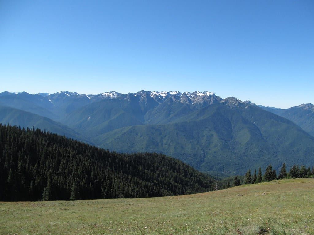
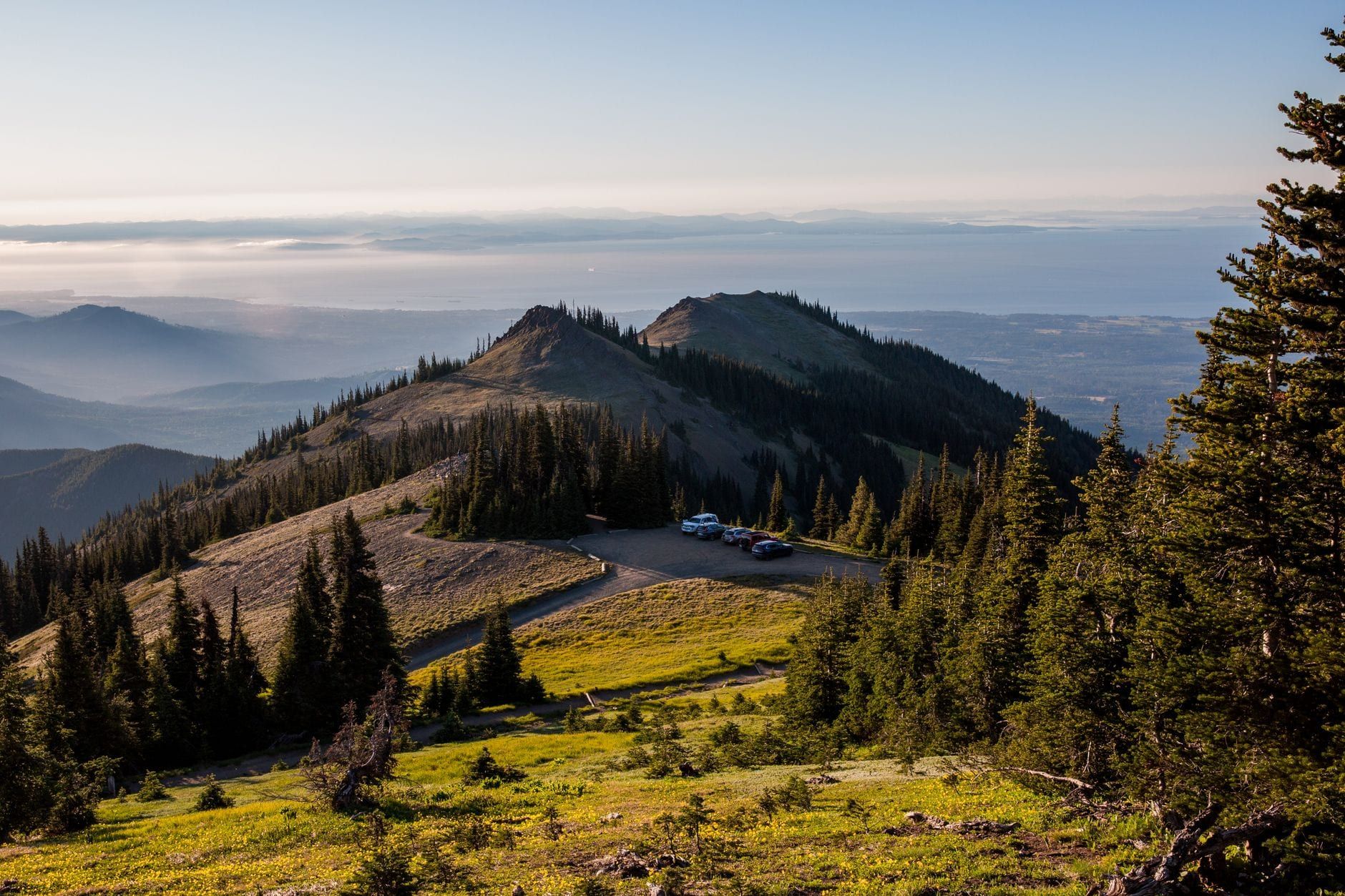
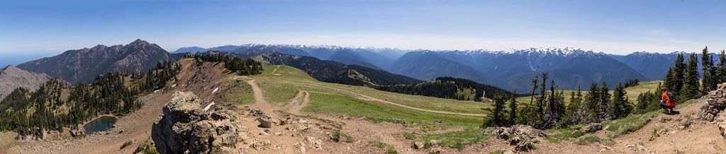
Leave Port Angeles by about 7:45 am. In peak season the parking queue backs up after 9 am, and the 18-mile climb to the ridge is half the show. At 5,200 feet, the views start in the parking lot: the Olympic Mountains spread out south, with Mount Olympus and its glaciers front and center on a clear day.
Hurricane Hill is the classic hike — 3.4 miles round trip, roughly 820 feet of gain on a paved surface, 1.5 to 2.5 hours. Klahane Ridge (5 miles, 1,500 feet) is the quieter, wilder pick for strong legs. If you'd rather not hike, the paved Big Meadow and Cirque Rim loops stay level and keep the panorama. Watch for Olympic marmots on the rocks; they live nowhere else on Earth. Our guide to the park's best hikes has more options by region.
If the webcam shows the ridge socked in, flip the day: do the waterfalls and the lake first, then come back up in late afternoon when clouds often lift. Since the visitor center fire there's nothing at the top but toilets and trash bins, so carry your food and water up.
Madison Falls
On the way back down, detour into the Elwha Valley for Madison Falls — a 0.1-mile paved walk to a 60-foot waterfall, one of the easiest stops in the park. The Elwha River here runs free again after the 2014 dam removal, one of the largest such projects in US history. Twenty minutes, tops.
Marymere Falls
Back on 101 west, park at the Storm King Ranger Station for Marymere Falls: 1.8 miles round trip through old-growth fir and hemlock to a 90-foot ribbon of water. The trail rolls gently and stays under canopy, which makes it the default rainy-day hike. Budget about 90 minutes.
Lake Crescent
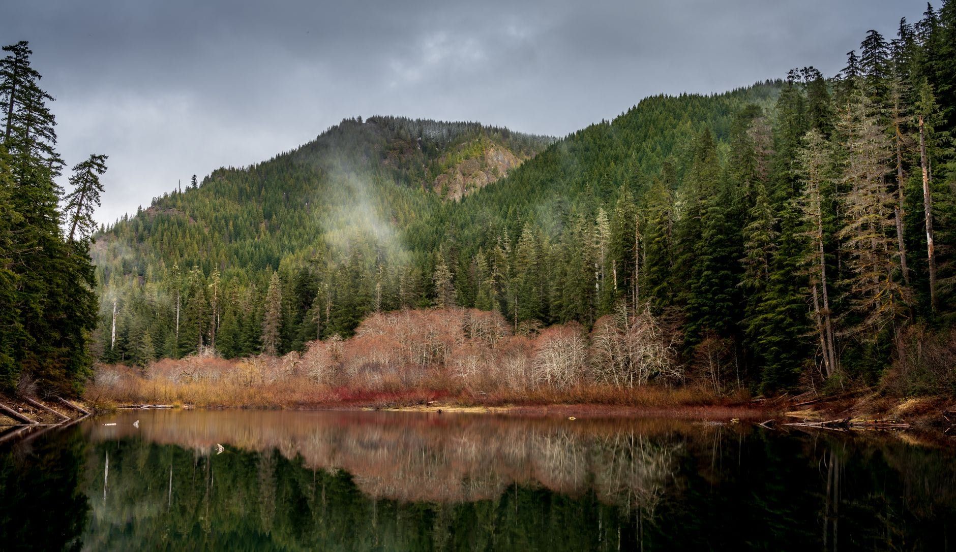
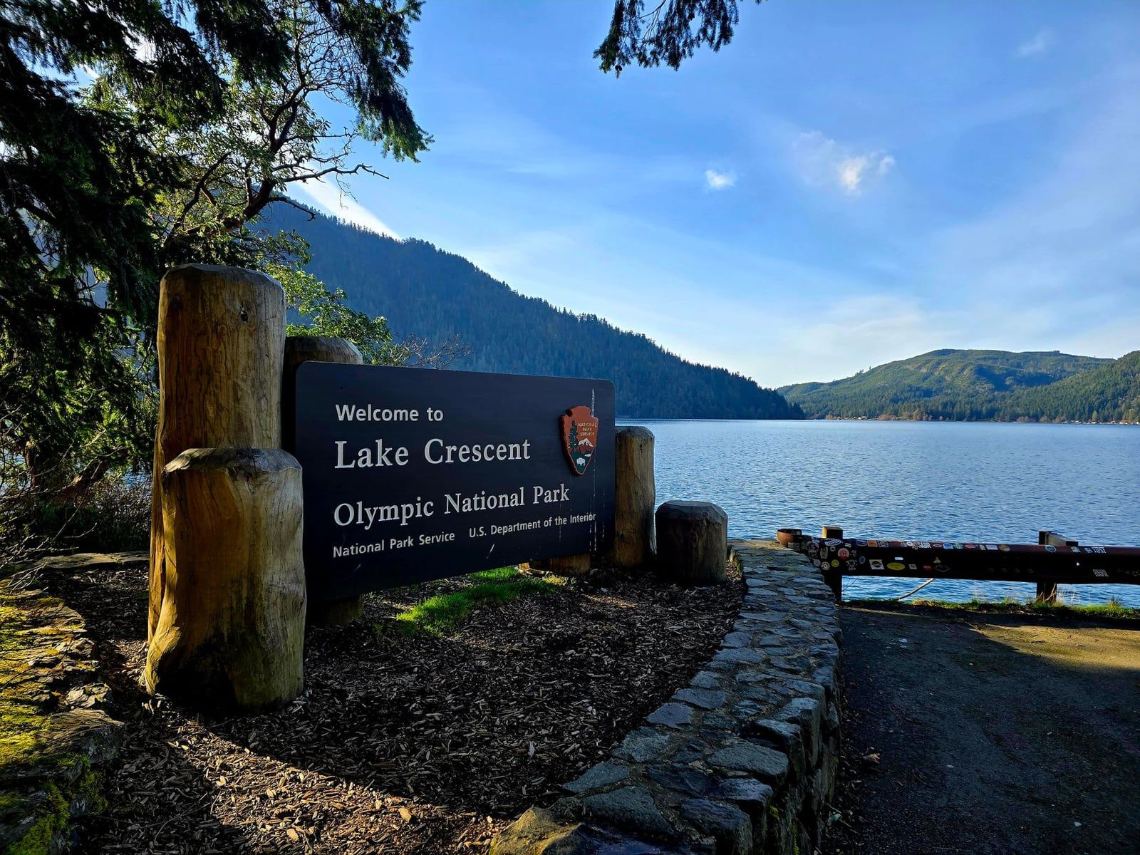
Thirty minutes from Port Angeles, Lake Crescent fills a glacial valley with water so clear and blue-green it looks lit from below. The 1915 Lake Crescent Lodge is the anchor: a dock, a lawn, rowboats and kayaks for rent in summer, and a dining room if you'd rather sit. The Moments in Time loop is a flat lakeside stroll; Devil's Punchbowl (2.1 miles round trip) adds a swim-hole cove for warm afternoons. Our Lake Crescent guide covers the rest.
The Optional Sol Duc Detour
Sol Duc Valley sits 1 hour 15 minutes from Port Angeles via a spur road off 101. The falls trail runs 1.6 miles round trip to a three-channel cascade, or you can swap boots for a soak in the pools at Sol Duc Hot Springs Resort. Take the detour only if Day 1 is running ahead of schedule — the road closes in winter, and it adds real time to the drive to Forks.
Evening: On to Forks
Continue west on 101 around the lake toward Forks — the stretch where cell coverage drops. Granny's Cafe on the highway is the classic dinner stop en route. If your legs and the sky hold out, Rialto Beach makes a dramatic sunset finish, with sea stacks and driftwood right off the parking lot. Verify the Mora Road status first: the stretch beyond Mora Campground is expected to close from July into early fall 2026 for repairs.
Day 2: Hoh Rain Forest & the Wild Coast
Day 2 trades altitude for moss and salt air: the Hoh Rain Forest first thing, lunch in Forks, then south down the coast to Ruby Beach and Kalaloch before the long drive back east.
Hoh Rain Forest
Arrive by 8:15–9 am. On a July morning the visitor-center lot was full soon after 8:15, and the NPS warns of long entrance-booth waits from May through September. It's 2 hours 15 minutes from Port Angeles but a short hop from a Forks bed — the entire reason for the base switch.
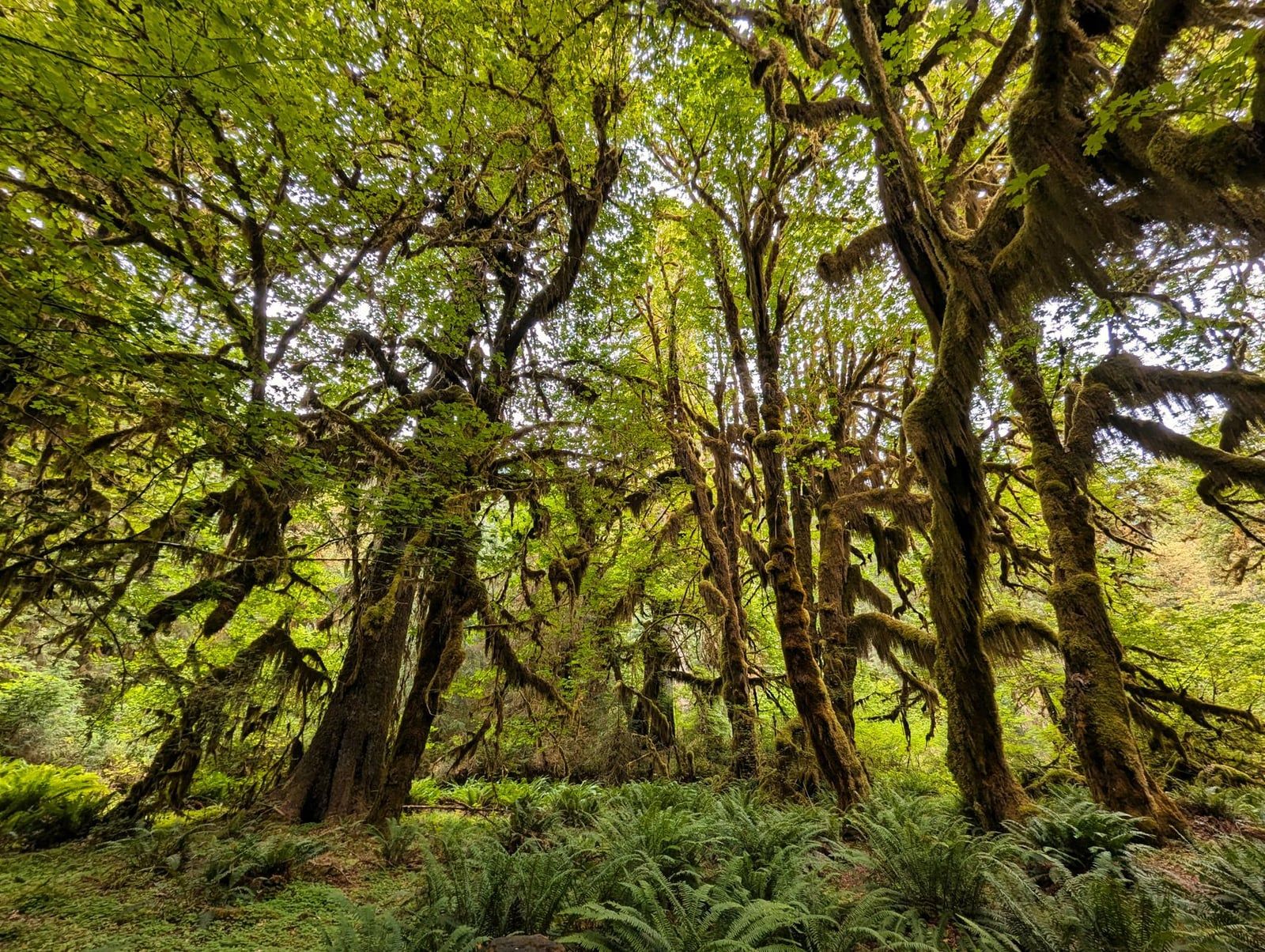
The Hall of Mosses loop, 0.8 miles with about 100 feet of gain, is the park's signature walk: bigleaf maples hung with club moss, ferns to knee height, spruce and hemlock more than 500 years old. The Spruce Nature Trail (1.2 miles) adds riverbank. With half a spare day, push up the Hoh River Trail toward Mineral Creek Falls, a 6–7-mile out-and-back. Rainfall here runs to almost 12 feet a year, and the moss is the proof. Roosevelt elk graze the clearings — keep at least 50 yards back.
Lunch in Forks
Forks, the town the Twilight series made famous, sits between the Hoh and the coast and is the practical lunch stop: diners, themed shops, and Forks Outfitters Thriftway for anything the coast will demand of you. Fill water bottles here too.
Ruby Beach
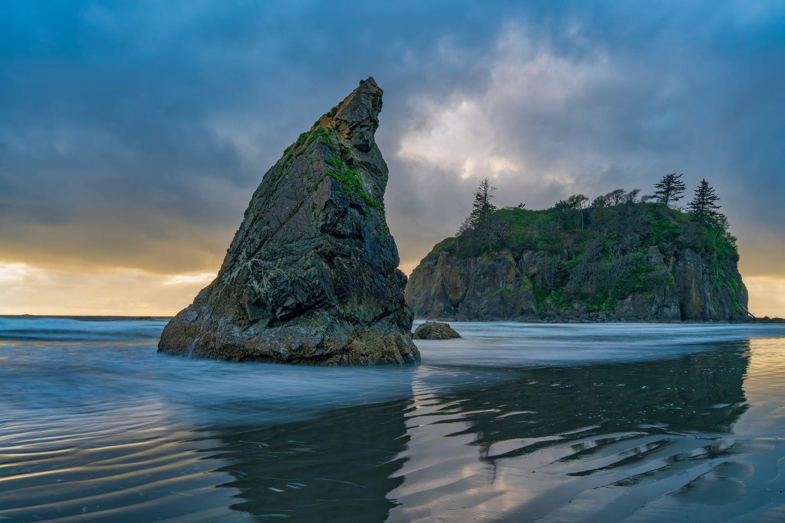
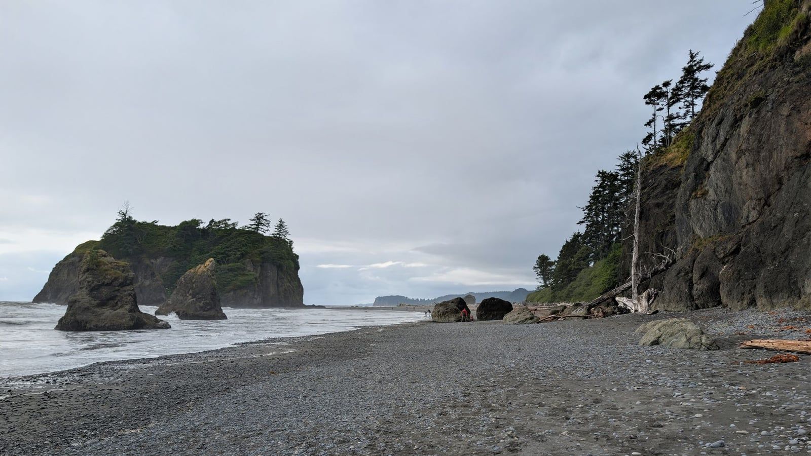
Ruby Beach is 53 minutes south of the Hoh on 101, and a short, wheelchair-friendly path runs from lot to sand. Sea stacks stand just offshore — Abbey Island chief among them — with a creek crossing and driftwood logs stacked like furniture. Usually more room than Rialto gets, and it's the best picnic stop of the two days. Our guide to the park's beaches ranks the rest of the coast.
Kalaloch: Beach 4 Tide Pools and the Tree of Life
A short drive farther south — Kalaloch is 2 hours 30 minutes from Port Angeles — Beach 4 is the tide-pool stop: sea stars and anemones in the rocks near low tide, a short scramble from the parking area. Time it with your tide chart; our tide pool guide explains what you'll see and when. The Tree of Life, a huge living log wedged above a hollowed-out bank of sand, sits on the beach below Kalaloch campground, and Kalaloch Lodge on the bluff is the wind-down option if you decide to stay a second coastal night instead of driving back.
The Rialto Swap
If the tides don't line up for the southern stops, or you skipped the Day 1 sunset, Rialto Beach and Hole in the Wall replace Ruby and Kalaloch neatly. Hole in the Wall is 1.5 miles north of the parking lot along the beach and dangerous at high tide — go within a couple of hours of low tide or not at all. Here's how the two stack up:
| Rialto Beach (Hole in the Wall) | Ruby Beach | |
|---|---|---|
| The walk | 1.5 miles one-way on sand and cobble | 5-minute paved path from the lot |
| Headline sight | A sea arch — Hole in the Wall — plus tide pools | Sea stacks including Abbey Island, driftwood, creek |
| Tide dependent | Yes — passable only near low tide | No — works at any tide |
| Best for | Hikers and sunset photographers | Families, picnics, quick stops |
| Access caveat | Mora Road closure expected July–early fall 2026 | None reported |
Heading Back
From the Kalaloch area, the drive back to Seattle runs about 3.5 hours. Leave by late afternoon if you need to be in the city the same night. The saner move is sleeping in Forks or Kalaloch again and driving back the next morning.
Logistics That Make or Break the Trip
Crowd timing comes down to two arrival windows, and both are before 9 am: the Hurricane Ridge lot (leave Port Angeles by 7:45) and the Hoh lot (full soon after 8:15 on summer mornings). Once lots fill, entry is metered and waits can run from 30 minutes to 2 hours. Outside those two, show up before 10 am or after 4 pm — Ruby Beach and Rialto fill midday too.
Tides gate the coast. Hole in the Wall is passable only near low tide, and Beach 4's pools only appear then. Grab a free tide chart at any visitor center or coastal ranger station, and call the park's road-and-weather line at 360-565-3131 for current conditions. On the sand: sneaker waves are real, never turn your back on the surf, and wear closed-toe shoes — coastal rock is slick even when dry.
Rain is a planning variable here, not a failure. If the ridge is buried in cloud, spend the day low: Marymere Falls, Lake Crescent, and the Hoh all sit under canopy and work in drizzle. Weather varies by ecosystem and by the hour — the coast can sit in fog while Port Angeles is sunny — so don't write off the day from your hotel window. Seasonally, June through September has the fullest access and longest daylight (near 5 am to 10 pm around the solstice); May and September trade a little reliability for far fewer people.
On the road, buffer every estimate. Highway 101 is a winding two-lane shared with logging trucks and RVs, and Google Maps is optimistic. Cell coverage disappears between Lake Crescent and Forks, so download offline maps before Port Angeles.
- Waterproof shell and warm mid-layer — temps swing 10–20°F in a day
- Closed-toe shoes with grip, even on beaches
- Free tide chart from any visitor center
- Offline maps downloaded before you leave Port Angeles
- Picnic supplies — food is scarce west of the lake
If You Have More Time
A third day is the real sweet spot for Olympic: it buys weather slack and unlocks the corners this route skips. Ranked by value for the driving they add:
Cape Flattery
The northwesternmost point of the contiguous US, past Neah Bay on the Makah reservation, reached by a short boardwalk trail to cliffs above sea caves and stacks — with views toward Canada on clear days. The single best half-day add-on, though it pulls you north while the park's best stops pull you south.
Second Beach
Near La Push, a forest trail drops to a wide sand beach backed by offshore sea stacks. An easy coastal add with no permit and none of Shi Shi's logistics — the pick if you just want one more beach.
Mount Storm King
For strong hikers only: relentless switchbacks above Lake Crescent, then a rope-assisted scramble to a ledge hanging over the water. Strenuous, exposed, and the best view on the Day 1 corridor.
With three or four days, the standard upgrades are the Ozette Triangle — a 9-mile boardwalk-and-beach loop past petroglyphs at Wedding Rocks — and the Quinault Rain Forest in the south, home to some of the largest known trees in the world. Our 3-day Olympic itinerary sequences all of it, with 2- and 4-day variants.
Frequently asked questions
Do you need a reservation or timed entry for Olympic National Park?
No. Entry requires only a pass — $30 per vehicle, valid 7 days — bought at the gate or in advance on Recreation.gov to skip the line. Wilderness Camping Permits ($8 per person per night plus a $6 reservation fee) apply only to overnight backcountry trips.
How much driving is involved in 2 days in Olympic National Park?
A lot — that's the main planning reality. Official NPS drive times from Port Angeles: Hurricane Ridge 45 minutes, Lake Crescent 30 minutes, Sol Duc Valley 1h15, Mora/Rialto 1h15, Hoh Rain Forest 2h15, Kalaloch 2h30. Switching bases to Forks after Day 1 is what keeps it manageable.
Where should you stay for a 2-day Olympic trip?
Split your nights: Port Angeles for night 1, Forks (or Kalaloch) for night 2 — the setup NPS rangers recommend to cut driving. In-park lodging like Lake Crescent Lodge, built in 1915, saves the most time but books out early for summer.
What's the best time of year for 2 days in Olympic?
Late June through September has the most reliable weather and full road access, but the Hoh runs very busy with long entrance waits from May through September. May and September offer similar access with fewer people. Winter means Friday–Sunday Hurricane Ridge access, chains required, and a closed Sol Duc Road.
Can you see Hurricane Ridge and the Hoh Rain Forest in one day?
They're 2 hours 15 minutes apart by road, so the pairing rarely works well. With two days, do mountains and Lake Crescent on Day 1 and rain forest plus coast on Day 2, splitting the park's three ecosystems across both days.
What time should you arrive at Hurricane Ridge and the Hoh Rain Forest?
Before 9 am at both. Leave Port Angeles by about 7:45 to beat the ridge parking queue, and reach the Hoh lot by 8:15–9 am — it fills quickly on summer mornings, and the NPS warns of entrance waits May through September.
Do I need a tide chart for Rialto Beach or Hole in the Wall?
Yes, for any plan beyond the parking lot. Hole in the Wall, 1.5 miles north along Rialto Beach, is dangerous at high tide, and the Kalaloch Beach 4 tide pools only appear near low tide. Tide charts are free at visitor centers; call the park's road-and-weather line at 360-565-3131 for conditions.
Is Olympic National Park worth visiting for just 2 days?
Yes. Two days covers a greatest-hits sample of all three ecosystems — mountains, rain forest, coast — if you route smartly along Highway 101 and skip the far corners. Three days is the more comfortable version, with slack for weather and the Ozette or Quinault areas.